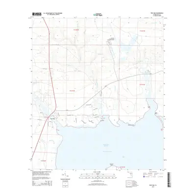
2015 Map of West Bay
USGS Topo · Published 2015About this map
West Bay serves as the focal point of this coastal survey, where the freshwater discharge of Crooked Creek and Burnt Mill Creek meets the saltwater of the Gulf of Mexico. The landscape is defined by the intricate finger-like projections of the shoreline, including Coon Point, Walsonham Point, and Graze Point, which shape the northern reaches of the bay. This era marks a significant transition in land use, as the extensive undeveloped wetlands and pine flatwoods are punctuated by the modern footprint of the Northwest Florida Beaches International Airport in the northern portion of the quadrangle.
Find a feature on this map
49 named features on this map. Tap any name to fly to it.
Don’t see what you’re looking for? This feature index may not catch every label — zoom into the map to look around manually.
Map Details
Editions of this 2015 West Bay Map
This is the sole edition of this map. No revisions or reprints were ever made.
Other maps of this area

1943 · Laguna Beach
USGS Topo · 1:31,680

1943 · Panama City
USGS Topo · 1:31,680

1943 · Panama City Beach
USGS Topo · 1:31,680

1943 · Seminole Hills
USGS Topo · 1:24,000

1943 · West Bay
USGS Topo · 1:24,000

1943 · Southport
USGS Topo · 1:24,000

1944 · Southport
USGS Topo · 1:24,000

1944 · Seminole Hills
USGS Topo · 1:31,680

1944 · West Bay
USGS Topo · 1:31,680

1944 · Crystal Lake
USGS Topo · 1:24,000