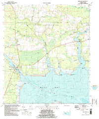
1994 Map of West Bay
USGS Topo · Published 1998About this map
The northern reaches of West Bay dominate this 1990s landscape, where the Intracoastal Waterway cuts through the marshy terrain. The settlement of West Bay sits near the water’s edge, marked by a local Cemetery and a nearby Drawbridge. Much of the northern interior is preserved within the Point Washington State Wildlife Management Area, a vast expanse of wetlands and timberland defined by the winding paths of Crooked Creek and Burnt Mill Creek.
Find a feature on this map
30 named features on this map. Tap any name to fly to it.
Don’t see what you’re looking for? This feature index may not catch every label — zoom into the map to look around manually.
Map Details
Editions of this 1994 West Bay Map
This is the sole edition of this map. No revisions or reprints were ever made.
Other maps of this area

1943 · Laguna Beach
USGS Topo · 1:31,680

1943 · Panama City
USGS Topo · 1:31,680

1943 · Panama City Beach
USGS Topo · 1:31,680

1943 · Seminole Hills
USGS Topo · 1:24,000

1943 · West Bay
USGS Topo · 1:24,000

1943 · Southport
USGS Topo · 1:24,000

1944 · Southport
USGS Topo · 1:24,000

1944 · Seminole Hills
USGS Topo · 1:31,680

1944 · West Bay
USGS Topo · 1:31,680

1944 · Crystal Lake
USGS Topo · 1:24,000