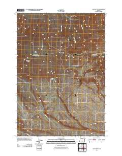
2011 Map of West Butte
USGS Topo · Published 2011About this map
West Butte and the Bear Creek Buttes define this high-desert landscape in central Oregon, where the water economy is clearly marked by human engineering and ephemeral flows. The presence of Hirsch Reservoir and Daly Reservoir indicates the critical importance of water storage in this arid environment, capturing seasonal runoff from drainages like Williamson Creek and Perry Creek. The land is shaped by volcanic geology and traditional cattle country features, with Sage Hollow tucked between the rises. Movement through the area is anchored by the West Butte Rd, while the southern edge is marked by the course of the Dry River. This 2011 survey provides a clear view of the modern infrastructure and natural topography of Deschutes County, recording the essential water sources and roads used by local ranchers and land managers.
Find a feature on this map
9 named features on this map. Tap any name to fly to it.
Don’t see what you’re looking for? This feature index may not catch every label — zoom into the map to look around manually.
Map Details
Editions of this 2011 West Butte Map
This is the sole edition of this map. No revisions or reprints were ever made.
Other maps of this area

1946 · Eagle Rock
USGS Topo · 1:62,500

1948 · Eagle Rock
USGS Topo · 1:62,500

1955 · Crescent
USGS Topo · 1:250,000

1955 · Bend
USGS Topo · 1:250,000

1957 · Crescent
USGS Topo · 1:250,000

1957 · Bend
USGS Topo · 1:250,000

1958 · Crescent
USGS Topo · 1:250,000

1958 · Bend
USGS Topo · 1:250,000

1962 · Powell Buttes
USGS Topo · 1:62,500

1966 · Millican SE
USGS Topo · 1:24,000