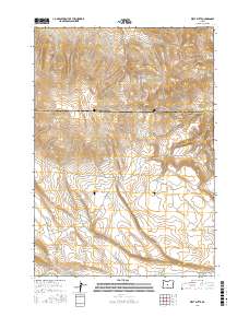
2017 Map of West Butte
USGS Topo · Published 2017About this map
West Butte and the Bear Creek Buttes dominate this high-desert landscape on the border of Crook and Deschutes counties. The terrain is defined by its scarce but vital water sources, with several isolated springs including Daly Spring, Odell Spring, and Tub Spring scattered across the upland slopes. Man-made catchments like Hirsch Reservoir and Daly Reservoir reflect the region's reliance on managed water for livestock or land use. The southern portion of the map is marked by the course of the Dry River, while W Butte Rd provides the primary corridor through this open country. The contrast between the drainage of Williamson Cr and the arid expanse of Sage Hollow illustrates the varied topographic character of this Oregon interior.
Find a feature on this map
18 named features on this map. Tap any name to fly to it.
Don’t see what you’re looking for? This feature index may not catch every label — zoom into the map to look around manually.
Map Details
Editions of this 2017 West Butte Map
This is the sole edition of this map. No revisions or reprints were ever made.
Other maps of this area

1946 · Eagle Rock
USGS Topo · 1:62,500

1948 · Eagle Rock
USGS Topo · 1:62,500

1955 · Crescent
USGS Topo · 1:250,000

1955 · Bend
USGS Topo · 1:250,000

1957 · Crescent
USGS Topo · 1:250,000

1957 · Bend
USGS Topo · 1:250,000

1958 · Crescent
USGS Topo · 1:250,000

1958 · Bend
USGS Topo · 1:250,000

1962 · Powell Buttes
USGS Topo · 1:62,500

1966 · Millican SE
USGS Topo · 1:24,000