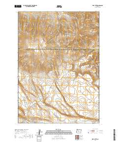
2020 Map of West Butte
USGS Topo · Published 2020About this map
The high desert landscape where Deschutes and Crook counties meet is defined by the volcanic prominence of West Butte and the surrounding Bear Creek Buttes. This 2020 topographic study illustrates the critical role of water management in an arid environment, highlighting significant catchment features such as Hirsch Reservoir and Daly Reservoir. The map reveals a network of natural water sources that have historically sustained life in this region, including Odell Spring, Daly Spring, and Tub Spring.
Find a feature on this map
18 named features on this map. Tap any name to fly to it.
Don’t see what you’re looking for? This feature index may not catch every label — zoom into the map to look around manually.
Map Details
Editions of this 2020 West Butte Map
This is the sole edition of this map. No revisions or reprints were ever made.
Other maps of this area

1946 · Eagle Rock
USGS Topo · 1:62,500

1948 · Eagle Rock
USGS Topo · 1:62,500

1955 · Crescent
USGS Topo · 1:250,000

1955 · Bend
USGS Topo · 1:250,000

1957 · Crescent
USGS Topo · 1:250,000

1957 · Bend
USGS Topo · 1:250,000

1958 · Crescent
USGS Topo · 1:250,000

1958 · Bend
USGS Topo · 1:250,000

1962 · Powell Buttes
USGS Topo · 1:62,500

1966 · Millican SE
USGS Topo · 1:24,000