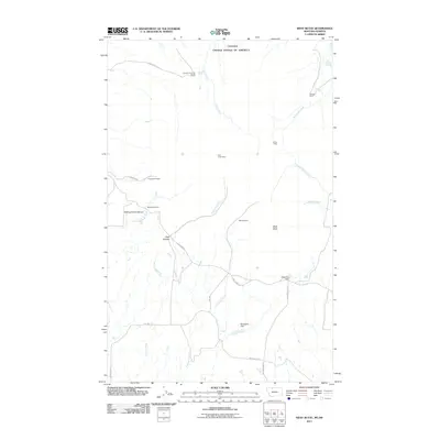
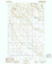
2011 Map of West Butte
USGS Topo · Published 2011About this map
The international border between Canada and the United States marks the northern limit of this high-plains landscape, where the Sweetgrass Hills rise above the surrounding terrain. Central to the area is the prominent landform of West Butte, which serves as a landmark for a network of working ranches and extraction sites. Land use is defined by a combination of livestock operations like the Quarter Circle ZN Ranch and O'Loughlin Ranch, alongside a history of small-scale mining. Several workings, including the El Pina Mine, Deer Creek Mine, and Monroe Mine, are tucked into the drainages of Deer Creek and Simmons Creek. The drainage patterns are further modified by the Berthelote Dam to the south. Local transit relies on established routes such as Coal Mine Rd and Rte-389, which connect these remote outposts across a landscape carved by Kicking Horse Canyon and Pratt Canyon.
Find a feature on this map
27 named features on this map. Tap any name to fly to it.
Don’t see what you’re looking for? This feature index may not catch every label — zoom into the map to look around manually.
Map Details
Editions of this 2011 West Butte Map
This is the sole edition of this map. No revisions or reprints were ever made.
Other maps of this area

1945 · West Butte
USGS Topo · 1:62,500

1954 · Shelby
USGS Topo · 1:250,000

1958 · Shelby
USGS Topo · 1:250,000

1962 · Cameron Lake
USGS Topo · 1:24,000

1962 · Fey Lakes
USGS Topo · 1:24,000

1984 · Sweet Grass Hills
USGS Topo · 1:100,000
1986 · West Butte
USGS Topo · 1:24,000
1986 · Beaupre Coulee
USGS Topo · 1:24,000
1986 · Fivemile Coulee East
USGS Topo · 1:24,000
1986 · Fivemile Coulee West
USGS Topo · 1:24,000