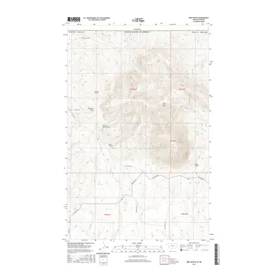
2017 Map of West Butte
USGS Topo · Published 2017About this map
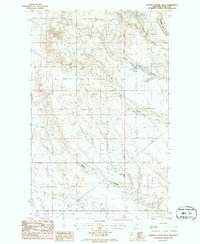
The Sweet Grass Hills dominate the northern landscape of Toole County, where the prominent elevation of West Butte stands just south of the international border between Canada and the United States. This terrain is characterized by a series of deep drainages and canyons, including Kicking Horse Canyon and Pratt Canyon, which channel seasonal water through the foothills. The naming of local landforms, such as Certain Coulee, O'Laughlin Coulee, and Greens Coulee, reflects the area's grazing and ranching history. Transportation in this high plains environment is defined by functional routes like Coal Mine Rd and Nine Mile Rd, which navigate the township and range grid. Numerous creeks, including Pike Cr, McDonald Cr, and Kicking Horse Cr, weave through the elevations, tracing the natural path of runoff toward the southern plains of Montana.
Find a feature on this map
29 named features on this map. Tap any name to fly to it.
Don’t see what you’re looking for? This feature index may not catch every label — zoom into the map to look around manually.
Map Details
Editions of this 2017 West Butte Map
This is the sole edition of this map. No revisions or reprints were ever made.
Other maps of this area

1945 · West Butte
USGS Topo · 1:62,500

1954 · Shelby
USGS Topo · 1:250,000

1958 · Shelby
USGS Topo · 1:250,000

1962 · Cameron Lake
USGS Topo · 1:24,000

1962 · Fey Lakes
USGS Topo · 1:24,000

1984 · Sweet Grass Hills
USGS Topo · 1:100,000
1986 · West Butte
USGS Topo · 1:24,000
1986 · Beaupre Coulee
USGS Topo · 1:24,000
1986 · Fivemile Coulee East
USGS Topo · 1:24,000
1986 · Fivemile Coulee West
USGS Topo · 1:24,000