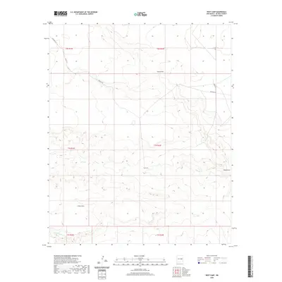
2020 Map of West Camp
USGS Topo · Published 2020About this map
West Camp sits in a high-desert landscape within De Baca County, characterized by the expansive elevation of Conejo Mesa and the drainage networks of the Pecos River basin. This 2020 survey illustrates a sparsely settled ranching environment where water sources like Yeso Cr and Guana Draw define the movement across the terrain. The map provides a look at the modern land management grid, showing the intersection of several townships including t2n r23e, t1n r24e, and t1s r23e. Transport in this arid region relies on a network of secondary routes and trails such as Renegade Rd, Bigote Rd, and Co Rd 1-19. In the southern portion of the quadrangle, the headwaters of Little Conejo Cr emerge, cutting through the mesas. The geographic layout reflects the enduring spatial patterns of New Mexico's rangelands, where named settlements are few and the landscape is primarily defined by its hydrology and relief.
Find a feature on this map
14 named features on this map. Tap any name to fly to it.
Don’t see what you’re looking for? This feature index may not catch every label — zoom into the map to look around manually.
Map Details
Editions of this 2020 West Camp Map
This is the sole edition of this map. No revisions or reprints were ever made.
Other maps of this area

1954 · Fort Sumner
USGS Topo · 1:250,000

1958 · Fort Sumner
USGS Topo · 1:250,000

1965 · Fort Sumner West
USGS Topo · 1:24,000

1966 · West Camp
USGS Topo · 1:24,000

1966 · Alamo Ranch
USGS Topo · 1:24,000

1966 · Ricardo
USGS Topo · 1:24,000

1966 · Horney Ranch
USGS Topo · 1:24,000

1966 · Yeso
USGS Topo · 1:24,000

1967 · Dunlap NE
USGS Topo · 1:24,000

1967 · Conejo Creek West
USGS Topo · 1:24,000