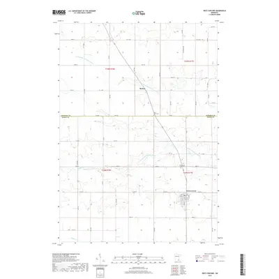
2019 Map of West Concord
USGS Topo · Published 2019About this map
The agricultural landscape of southeastern Minnesota is defined by the winding course of the Middle Fork Zumbro River and its various tributaries as they cross the Dodge and Goodhue County line. This area features the concentrated settlement of West Concord, where a dense grid of streets and a central post office mark the local economic hub. To the north, the smaller community of Skyberg sits near the N Br Middle Fork Zumbro River, illustrating the dispersed residential patterns common in the region. Local history and genealogy are anchored by established sites like Hegre Church Cem and Saint Vincent de Paul Cem, which serve as significant landmarks amidst the section-line roads and rolling topography. The drainage of Pearl Cr and Milliken Cr further shapes the terrain, dictating the placement of rural homesteads and connecting the upland farms to the larger river system.
Find a feature on this map
58 named features on this map. Tap any name to fly to it.
Don’t see what you’re looking for? This feature index may not catch every label — zoom into the map to look around manually.
Map Details
Editions of this 2019 West Concord Map
This is the sole edition of this map. No revisions or reprints were ever made.
Other maps of this area

1953 · Saint Paul
USGS Topo · 1:250,000

1959 · Saint Paul
USGS Topo · 1:250,000

1960 · Nerstrand
USGS Topo · 1:24,000

1962 · Moland
USGS Topo · 1:24,000

1962 · Owatonna SE
USGS Topo · 1:24,000

1965 · Dodge Center
USGS Topo · 1:24,000

1965 · Concord
USGS Topo · 1:24,000

1965 · Claremont
USGS Topo · 1:24,000

1965 · West Concord
USGS Topo · 1:24,000

1968 · Kenyon
USGS Topo · 1:24,000
Featured Places
- West Concord, MN
- Cherry Grove Township, MN
- Kenyon Township, MN
- West Gate Mobile Home Park, West Concord
- Skyberg, MN