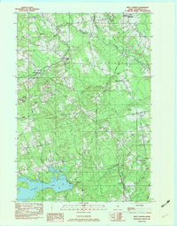
1982 Map of West Corinth
USGS Topo · Published 1983About this map
Kenduskeag Stream meanders through the heart of Penobscot County, defining the rural character of these interconnected townships in the early 1980s. The landscape is marked by a network of small settlements including Exeter Mills, East Exeter, and West Corinth, which appear as quiet crossroads within a heavily wooded and stream-fed terrain. The density of family and town burial grounds, such as Osgood Cem, Boutelle Cem, and Mt Pleasant Cem, offers significant evidence for genealogists tracing ancestral homesteads in the Exeter and Corinth areas.
Find a feature on this map
54 named features on this map. Tap any name to fly to it.
Don’t see what you’re looking for? This feature index may not catch every label — zoom into the map to look around manually.
Map Details
Editions of this 1982 West Corinth Map
2 editions found
Other maps of this area

1902 · Bangor
USGS Topo · 1:62,500

1931 · Stetson
USGS Topo · 1:48,000

1932 · Dover-Foxcroft
USGS Topo · 1:48,000

1933 · Boyd Lake
USGS Topo · 1:62,500

1935 · Dover-Foxcroft
USGS Topo · 1:62,500

1935 · Stetson
USGS Topo · 1:62,500

1942 · Bangor
USGS Topo · 1:62,500

1946 · Bangor
USGS Topo · 1:62,500

1948 · Bangor
USGS Topo · 1:250,000

1951 · Boyd Lake
USGS Topo · 1:50,000