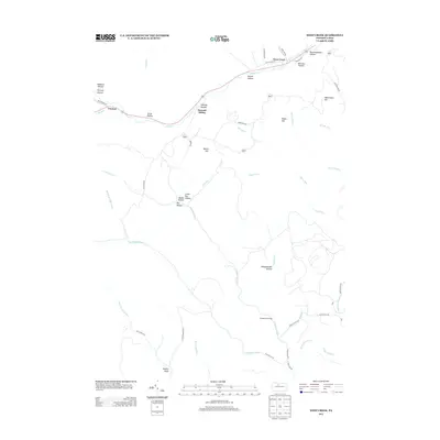
2013 Map of West Creek
USGS Topo · Published 2013About this map
West Creek and its neighboring settlements occupy the narrow valleys of Elk County, where the winding course of the West Creek waterway dictates the path of travel and habitation. This area of Benezette Township is defined by a dense network of steep drainages, known locally as hollows and drafts, which separate prominent rises such as Whittimore Hill and Bryan Hill. The small settlements of Truman and Howard Siding follow the creek and the primary roadway corridor, illustrating the traditional Appalachian pattern of development constrained by topography.
Find a feature on this map
52 named features on this map. Tap any name to fly to it.
Don’t see what you’re looking for? This feature index may not catch every label — zoom into the map to look around manually.
Map Details
Editions of this 2013 West Creek Map
This is the sole edition of this map. No revisions or reprints were ever made.
Other maps of this area

1941 · Benezette
USGS Topo · 1:62,500

1943 · Benezette
USGS Topo · 1:62,500

1945 · Driftwood
USGS Topo · 1:48,000

1945 · Driftwood
USGS Topo · 1:24,000

1945 · Cameron
USGS Topo · 1:24,000

1947 · Cameron
USGS Topo · 1:24,000
1947 · Driftwood
USGS Topo · 1:24,000

1948 · Crosby
USGS Topo · 1:62,500

1948 · Emporium
USGS Topo · 1:62,500

1948 · Emporium
USGS Topo · 1:24,000
Featured Places
- Benezette Township, PA
- Gibson Township, PA
- Lumber Township, PA
- Shippen Township, PA
- Truman, Shippen Township