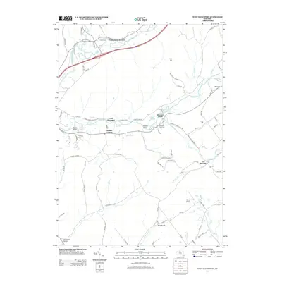
2013 Map of West Davenport
USGS Topo · Published 2013About this map
Charlotte Creek and the Susquehanna River define the local topography of this section of Otsego and Delaware Counties, where numerous small hollows like Prosser Hollow and Pumpkin Hollow provide a glimpse into the historic settlement patterns of the region. The map tracks the concentration of communities along these waterways, from Colliersville at the confluence of the river and Schenevus Creek to the outlying hamlet of East Meredith. Genealogists will find a wealth of local burial grounds, including the Newell Cemetery and McMinn Cemetery, which sit alongside historic transit corridors such as the Pindars Corners-Otsego County Line Road. The landscape is largely defined by its agricultural and creek-side development, punctuated by notable local landmarks like the Tomahawk Hills Airport and the gathering points at Pindars Corners and Shackport.
Find a feature on this map
93 named features on this map. Tap any name to fly to it.
Don’t see what you’re looking for? This feature index may not catch every label — zoom into the map to look around manually.
Map Details
Editions of this 2013 West Davenport Map
This is the sole edition of this map. No revisions or reprints were ever made.
Other maps of this area

1907 · Cooperstown
USGS Topo · 1:62,500

1909 · Cooperstown
USGS Topo · 1:62,500

1909 · Delhi
USGS Topo · 1:62,500

1910 · Hartwick
USGS Topo · 1:62,500

1911 · Delhi
USGS Topo · 1:62,500

1912 · Hartwick
USGS Topo · 1:62,500

1915 · Oneonta
USGS Topo · 1:62,500

1918 · Oneonta
USGS Topo · 1:62,500

1943 · Delhi
USGS Topo · 1:24,000

1943 · Mt Vision
USGS Topo · 1:24,000