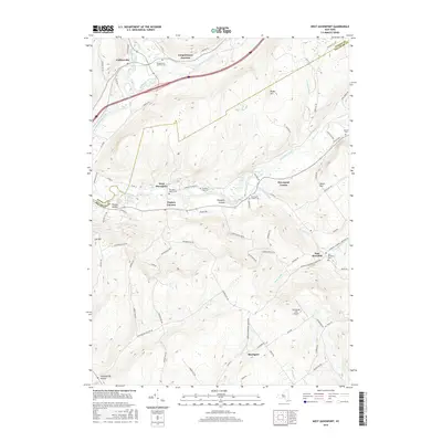
2016 Map of West Davenport
USGS Topo · Published 2016About this map
Schenevus Creek joins the Susquehanna River near Colliersville in this 2016 survey of the northern Catskills foothills. The landscape is defined by its deep hollows and narrow valleys, where small settlements like West Davenport, Pindars Corners, and Pumpkin Hollow follow the course of Charlotte Creek. These valley corridors served as the primary routes for development, evidenced by the concentration of local burial grounds including the Charlotte Valley Cem and McMinn Cem.
Find a feature on this map
87 named features on this map. Tap any name to fly to it.
Don’t see what you’re looking for? This feature index may not catch every label — zoom into the map to look around manually.
Map Details
Editions of this 2016 West Davenport Map
This is the sole edition of this map. No revisions or reprints were ever made.
Other maps of this area

1907 · Cooperstown
USGS Topo · 1:62,500

1909 · Cooperstown
USGS Topo · 1:62,500

1909 · Delhi
USGS Topo · 1:62,500

1910 · Hartwick
USGS Topo · 1:62,500

1911 · Delhi
USGS Topo · 1:62,500

1912 · Hartwick
USGS Topo · 1:62,500

1915 · Oneonta
USGS Topo · 1:62,500

1918 · Oneonta
USGS Topo · 1:62,500

1943 · Delhi
USGS Topo · 1:24,000

1943 · Mt Vision
USGS Topo · 1:24,000