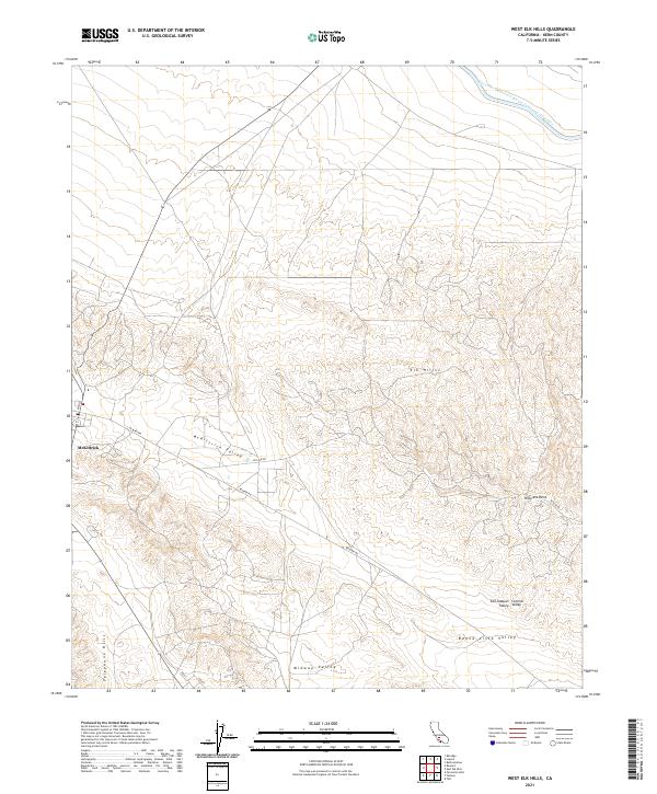
2021 Map of West Elk Hills
USGS Topo · Published 2021About this map
Elk Hills and the surrounding terrain define this part of Kern County, where the landscape transitions through a series of distinct geographic basins. The Governor Edmund G Brown California Aqueduct cuts through the northern reaches, marking the critical water infrastructure that supports the region. The settlement of McKittrick sits at the edge of the Mc Kittrick Valley, serving as a focal point for local activity in an area otherwise characterized by oil exploration and varied topography.
Find a feature on this map
20 named features on this map. Tap any name to fly to it.
Don’t see what you’re looking for? This feature index may not catch every label — zoom into the map to look around manually.
Map Details
Editions of this 2021 West Elk Hills Map
This is the sole edition of this map. No revisions or reprints were ever made.
Other maps of this area

1910 · Buena Vista Lake
USGS Topo · 1:125,000

1912 · McKittrick
USGS Topo · 1:125,000

1912 · Buena Vista Lake
USGS Topo · 1:125,000

1931 · Lokern
USGS Topo · 1:31,680

1932 · West Elk Hills
USGS Topo · 1:31,680

1932 · East Elk Hills
USGS Topo · 1:31,680
1932 · Buttonwillow
USGS Topo · 1:31,680

1934 · Lokern
USGS Topo · 1:31,680
1942 · Buttonwillow
USGS Topo · 1:62,500
1943 · Belridge
USGS Topo · 1:31,680