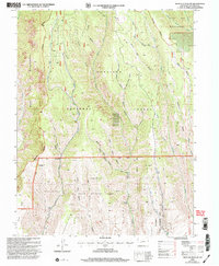
2001 Map of West Elk Peak SW
USGS Topo · Published 2004About this map
The Gunnison National Forest dominates this mountain landscape, defined by a dense network of drainage systems that descend from the high country toward the south. Historically significant labels such as Slab Mill Gulch and Burnt Mill Gulch suggest early timber activity in the region, while the transition from the protected West Elk Wilderness in the northwest to the Sapinero State Wildlife Area further south reflects evolving land management priorities. The terrain is deeply incised by prominent waterways including West Elk Creek and the bifurcated East Fork and West Fork Dry Creeks. Notable landmarks such as Tenderfoot Hill and the broad Mesa in the southwest corner serve as anchor points for understanding the topographical relief of this part of Colorado.
Find a feature on this map
34 named features on this map. Tap any name to fly to it.
Don’t see what you’re looking for? This feature index may not catch every label — zoom into the map to look around manually.
Map Details
Editions of this 2001 West Elk Peak SW Map
This is the sole edition of this map. No revisions or reprints were ever made.
Other maps of this area

1908 · Uncompahgre
USGS Topo · 1:125,000

1911 · Uncompahgre
USGS Topo · 1:125,000

1954 · Iola
USGS Topo · 1:24,000

1954 · Mc Intosh Mountain
USGS Topo · 1:24,000

1954 · West Elk Peak SW
USGS Topo · 1:24,000

1954 · Little Soap Park
USGS Topo · 1:24,000

1954 · Cebolla
USGS Topo · 1:24,000

1954 · Sapinero
USGS Topo · 1:24,000

1956 · Montrose
USGS Topo · 1:250,000

1959 · Montrose
USGS Topo · 1:250,000