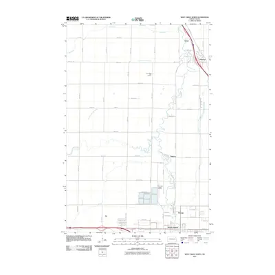
2011 Map of West Fargo North
USGS Topo · Published 2011About this map
West Fargo anchor the southern edge of this map, reflecting the urban expansion of the Red River Valley in the early 21st century. The landscape is defined by the meandering path of the Maple River, which winds through the central portion of the quadrangle before meeting the northern outskirts of Riverside. This waterway, along with the Rush River and its Lower Branch, dictates the drainage of the flat agricultural plains surrounding the growing settlements. The map documents important local landmarks for genealogists and historians, including the Oak Wood Cemetery near Harwood and the Lower Maple River Cemetery further south. Near the established neighborhoods of Pinkham, the presence of the West Fargo Utility Airport highlights the specialized infrastructure supporting this region. Small rail-side points like Fife persist amidst a network of section-line roads and emerging residential developments.
Find a feature on this map
57 named features on this map. Tap any name to fly to it.
Don’t see what you’re looking for? This feature index may not catch every label — zoom into the map to look around manually.
Map Details
Editions of this 2011 West Fargo North Map
This is the sole edition of this map. No revisions or reprints were ever made.
Other maps of this area

1895 · Fargo
USGS Topo · 1:125,000

1895 · Casselton
USGS Topo · 1:125,000

1897 · Fargo
USGS Topo · 1:125,000

1897 · Casselton
USGS Topo · 1:125,000

1952 · Grand Forks
USGS Topo · 1:250,000

1953 · Fargo
USGS Topo · 1:250,000

1956 · Fargo
USGS Topo · 1:250,000

1956 · Grand Forks
USGS Topo · 1:250,000

1959 · Fargo North
USGS Topo · 1:24,000

1959 · South West Fargo
USGS Topo · 1:24,000