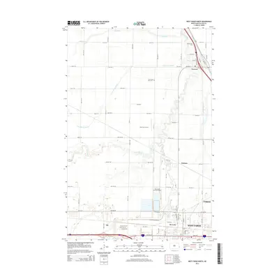
2014 Map of West Fargo North
USGS Topo · Published 2014About this map
The Sheyenne River and Maple River converge in this fertile Red River Valley landscape, shaping the development of West Fargo and its surrounding communities. By the mid-2010s, the transition from agricultural sections to urban infrastructure is evident in the sprawling grid connecting Riverside and the outskirts of Fargo. Significant local landmarks include the Jacob Gust Airport and the West Fargo Municipal Airport, highlighting the region's importance as a transportation hub.
Find a feature on this map
59 named features on this map. Tap any name to fly to it.
Don’t see what you’re looking for? This feature index may not catch every label — zoom into the map to look around manually.
Map Details
Editions of this 2014 West Fargo North Map
This is the sole edition of this map. No revisions or reprints were ever made.
Other maps of this area

1895 · Fargo
USGS Topo · 1:125,000

1895 · Casselton
USGS Topo · 1:125,000

1897 · Fargo
USGS Topo · 1:125,000

1897 · Casselton
USGS Topo · 1:125,000

1952 · Grand Forks
USGS Topo · 1:250,000

1953 · Fargo
USGS Topo · 1:250,000

1956 · Fargo
USGS Topo · 1:250,000

1956 · Grand Forks
USGS Topo · 1:250,000

1959 · Fargo North
USGS Topo · 1:24,000

1959 · South West Fargo
USGS Topo · 1:24,000