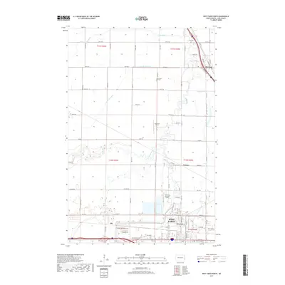
2017 Map of West Fargo North
USGS Topo · Published 2017About this map
The Sheyenne River meanders through the eastern plains of North Dakota, anchoring a landscape where agricultural heritage meets growing suburban centers. In the southern portion of this 2017 survey, the city of West Fargo is clearly delineated alongside smaller residential pockets like Riverside and Fife. The presence of West Fargo Municipal Airport and Jacob Gust Airport indicates the regional importance of aviation and light transport. Northward, the town of Harwood sits near the convergence of major transit corridors and the river's winding course. The map documents the enduring rural character through family and community landmarks such as Oak Wood Cem and Lower Maple River Cem, while the intricate network of county roads like Co Rd 20 and Cty Rd 10 reveals the systematic organization of the Red River Valley.
Find a feature on this map
51 named features on this map. Tap any name to fly to it.
Don’t see what you’re looking for? This feature index may not catch every label — zoom into the map to look around manually.
Map Details
Editions of this 2017 West Fargo North Map
This is the sole edition of this map. No revisions or reprints were ever made.
Other maps of this area

1895 · Fargo
USGS Topo · 1:125,000

1895 · Casselton
USGS Topo · 1:125,000

1897 · Fargo
USGS Topo · 1:125,000

1897 · Casselton
USGS Topo · 1:125,000

1952 · Grand Forks
USGS Topo · 1:250,000

1953 · Fargo
USGS Topo · 1:250,000

1956 · Fargo
USGS Topo · 1:250,000

1956 · Grand Forks
USGS Topo · 1:250,000

1959 · Fargo North
USGS Topo · 1:24,000

1959 · South West Fargo
USGS Topo · 1:24,000