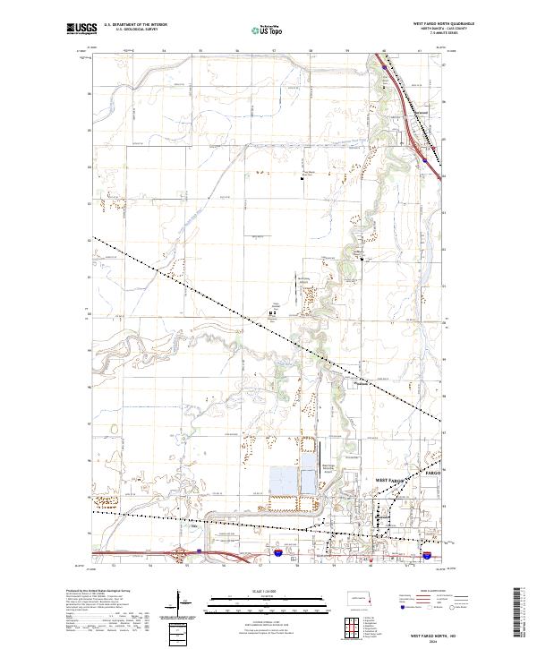
2024 Map of West Fargo North
USGS Topo · Published 2024About this map
The Sheyenne River and Maple River converge in this fertile Red River Valley landscape, shaping the development of West Fargo and its surrounding communities. Several historic burial sites, including the Sheyenne Pioneer Cem and Oak Wood Cem, are preserved among the modern suburban expansion and industrial corridors. The northern extent of the map centers on Harwood, where the Rush River joins the Sheyenne, while the southern section showcases the growth of Riverside and the industrial infrastructure near Fife. This contemporary survey reveals the complex drainage network of the Lower Branch Rush River alongside regional aviation hubs like the West Fargo Municipal Airport and the Jacob Gust Airport. The layout of section lines and township boundaries, such as t140n r49w, continues to dictate the orientation of both agricultural tracts and residential subdivisions.
Find a feature on this map
57 named features on this map. Tap any name to fly to it.
Don’t see what you’re looking for? This feature index may not catch every label — zoom into the map to look around manually.
Map Details
Editions of this 2024 West Fargo North Map
This is the sole edition of this map. No revisions or reprints were ever made.
Other maps of this area

1895 · Fargo
USGS Topo · 1:125,000

1895 · Casselton
USGS Topo · 1:125,000

1897 · Fargo
USGS Topo · 1:125,000

1897 · Casselton
USGS Topo · 1:125,000

1952 · Grand Forks
USGS Topo · 1:250,000

1953 · Fargo
USGS Topo · 1:250,000

1956 · Fargo
USGS Topo · 1:250,000

1956 · Grand Forks
USGS Topo · 1:250,000

1959 · Fargo North
USGS Topo · 1:24,000

1959 · South West Fargo
USGS Topo · 1:24,000