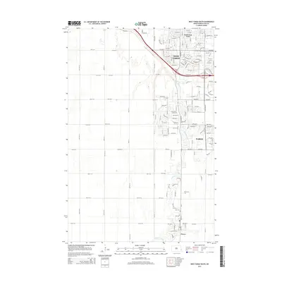
2014 Map of West Fargo South
USGS Topo · Published 2014About this map
The Sheyenne River defines the landscape of Cass County as it meanders through the rapidly developing corridor between West Fargo and Horace. This 2014 survey captures the interface of dense suburban expansion and the agricultural heritage of the Red River Valley. The map shows the grid-like residential growth of South West Fargo and the western reaches of Fargo, where modern street names like Stand Ave and Main Ave W meet older landmarks. Traces of the area's pioneer history remain visible through family-connected sites such as Brink Cem and Horace Cem, which stand as quiet anchors amidst the new infrastructure of the early twenty-first century. This record provides a detailed look at how the southern Cass County settlements have integrated the river's natural path into their modern urban planning.
Find a feature on this map
126 named features on this map. Tap any name to fly to it.
Don’t see what you’re looking for? This feature index may not catch every label — zoom into the map to look around manually.
Map Details
Editions of this 2014 West Fargo South Map
This is the sole edition of this map. No revisions or reprints were ever made.
Other maps of this area

1895 · Fargo
USGS Topo · 1:125,000

1895 · Casselton
USGS Topo · 1:125,000

1897 · Fargo
USGS Topo · 1:125,000

1897 · Casselton
USGS Topo · 1:125,000

1953 · Fargo
USGS Topo · 1:250,000

1956 · Fargo
USGS Topo · 1:250,000

1959 · Kindred
USGS Topo · 1:24,000

1959 · Fargo North
USGS Topo · 1:24,000

1959 · South West Fargo
USGS Topo · 1:24,000

1959 · Fargo South
USGS Topo · 1:24,000