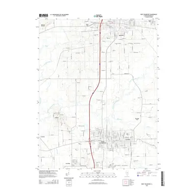
2015 Map of West Frankfort
USGS Topo · Published 2015About this map
Benton and West Frankfort anchor this mid-2010s survey of southern Illinois, where the developed corridors of the regional highway system intersect with the meandering courses of the Middle Fork Big Muddy River and Ewing Creek. The map provides a detailed view of the community layout between West City and Frankfort, highlighting a high density of burial sites that speak to the long-standing family roots in this part of Franklin County. Notable locations such as Saint Joseph Cem, Masonic-Oddfellow Cem, and Tower Height Cem are clearly marked alongside the grid of small-town streets.
Find a feature on this map
195 named features on this map. Tap any name to fly to it.
Don’t see what you’re looking for? This feature index may not catch every label — zoom into the map to look around manually.
Map Details
Editions of this 2015 West Frankfort Map
This is the sole edition of this map. No revisions or reprints were ever made.
Other maps of this area

1909 · West Frankfort
USGS Topo · 1:62,500

1910 · Herrin
USGS Topo · 1:62,500

1926 · Duquoin
USGS Topo · 1:62,500

1936 · Herrin
USGS Topo · 1:62,500

1939 · Ina
USGS Topo · 1:62,500

1941 · West Frankfort
USGS Topo · 1:62,500

1943 · Ina
USGS Topo · 1:62,500

1949 · Paducah
USGS Topo · 1:250,000

1950 · Paducah
USGS Topo · 1:250,000

1954 · Paducah
USGS Topo · 1:250,000