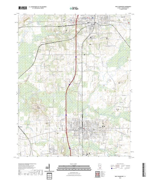
2024 Map of West Frankfort
USGS Topo · Published 2024About this map
Benton and West Frankfort anchor this detailed study of southern Illinois, where the urban grid of the county seat meets the industrial and agricultural corridors of the Big Muddy River valley. The map reveals a high density of civic and fraternal history, centered on the Franklin County Courthouse and a remarkably thorough network of cemeteries including the Masonic and Oddfellows Cem, the County Poor Farm Cem, and the Lithuanian Cem. These sites, alongside numerous neighborhood burial grounds like Neal Cem and Denning Cem, provide a precise spatial record for genealogical research in Franklin County.
Find a feature on this map
126 named features on this map. Tap any name to fly to it.
Don’t see what you’re looking for? This feature index may not catch every label — zoom into the map to look around manually.
Map Details
Editions of this 2024 West Frankfort Map
This is the sole edition of this map. No revisions or reprints were ever made.
Other maps of this area

1909 · West Frankfort
USGS Topo · 1:62,500

1910 · Herrin
USGS Topo · 1:62,500

1926 · Duquoin
USGS Topo · 1:62,500

1936 · Herrin
USGS Topo · 1:62,500

1939 · Ina
USGS Topo · 1:62,500

1941 · West Frankfort
USGS Topo · 1:62,500

1943 · Ina
USGS Topo · 1:62,500

1949 · Paducah
USGS Topo · 1:250,000

1950 · Paducah
USGS Topo · 1:250,000

1954 · Paducah
USGS Topo · 1:250,000