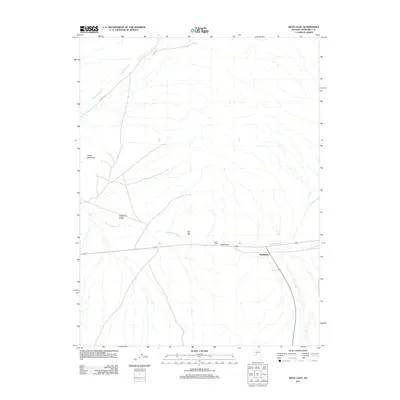
2011 Map of West Gate
USGS Topo · Published 2011About this map
Middlegate and West Gate anchor this high-desert landscape in Churchill County, marking a vital junction where the highway cuts through the mountainous terrain. The map details an arid environment defined by seasonal watercourses like Wonder Wash and Dixie Valley Wash, which flow from the slopes of Chalk Mountain toward the basin of the Stingaree Valley. Industrial history is represented by the West Gate Mill, situated north of the primary road, suggesting the area's long-standing connection to local mining or processing activities. This 2011 survey captures the sparse infrastructure of the region, showing how modern transit corridors follow the natural breaks in the topography such as the one used by Bench Creek to the east.
Find a feature on this map
10 named features on this map. Tap any name to fly to it.
Don’t see what you’re looking for? This feature index may not catch every label — zoom into the map to look around manually.
Map Details
Editions of this 2011 West Gate Map
This is the sole edition of this map. No revisions or reprints were ever made.
Other maps of this area

1908 · Carson Sink
USGS Topo · 1:250,000

1910 · Carson Sink
USGS Topo · 1:250,000

1955 · Millett
USGS Topo · 1:250,000

1957 · Reno
USGS Topo · 1:250,000

1959 · Reno
USGS Topo · 1:250,000

1959 · Millett
USGS Topo · 1:250,000

1960 · Reno
USGS Topo · 1:250,000

1969 · Camp Creek Canyon
USGS Topo · 1:24,000
1969 · Quartzite Mtn NW
USGS Topo · 1:24,000

1969 · Eastgate
USGS Topo · 1:24,000