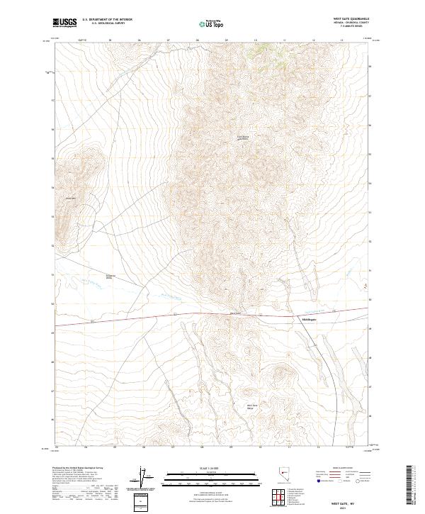
2021 Map of West Gate
USGS Topo · Published 2021About this map
Middlegate and the small settlement of West Gate anchor this high-desert landscape in Churchill County, where the southern reaches of the Clan Alpine Mountains meet the northern edge of the West Gate Range. The terrain is defined by dry drainage systems including Wonder Wash and the prominent Dixie Valley Wash, which cuts across the central flats of the Stingaree Valley. These features reveal a landscape where transportation routes were historically dictated by the rare passes between mountain massifs, such as the gap between the range and Chalk Mtn. As a 2021 update to the GNIS records and hydrography datasets, the map illustrates the persistence of these remote high-altitude ranching and transit corridors through the Nevada interior.
Find a feature on this map
14 named features on this map. Tap any name to fly to it.
Don’t see what you’re looking for? This feature index may not catch every label — zoom into the map to look around manually.
Map Details
Editions of this 2021 West Gate Map
This is the sole edition of this map. No revisions or reprints were ever made.
Other maps of this area

1908 · Carson Sink
USGS Topo · 1:250,000

1910 · Carson Sink
USGS Topo · 1:250,000

1955 · Millett
USGS Topo · 1:250,000

1957 · Reno
USGS Topo · 1:250,000

1959 · Reno
USGS Topo · 1:250,000

1959 · Millett
USGS Topo · 1:250,000

1960 · Reno
USGS Topo · 1:250,000

1969 · Camp Creek Canyon
USGS Topo · 1:24,000
1969 · Quartzite Mtn NW
USGS Topo · 1:24,000

1969 · Eastgate
USGS Topo · 1:24,000