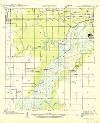
1947 Map of West Lake
USGS Topo · Published 1947About this map
The Calcasieu River defines the industrial and maritime landscape of this Calcasieu Parish region, winding southward toward Moss Lake and Prien Lake. In the late 1940s, the Lake Charles Ship Canal bisects the terrain, illustrating the critical role of waterborne commerce as it connects to the Port of Lake Charles. This waterway-centric development is balanced by the presence of the Kansas City Southern railroad and U S Highway No 90 to the north, which serve the growing communities of Sulphur and West Lake.
Find a feature on this map
29 named features on this map. Tap any name to fly to it.
Don’t see what you’re looking for? This feature index may not catch every label — zoom into the map to look around manually.
Map Details
Editions of this 1947 West Lake Map
This is the sole edition of this map. No revisions or reprints were ever made.
Other maps of this area

1932 · Moss Lake
USGS Topo · 1:31,680

1932 · Lake Charles NW
USGS Topo · 1:31,680

1932 · Lake Charles SW
USGS Topo · 1:31,680

1935 · Buhler
USGS Topo · 1:31,680

1935 · Moss Bluff
USGS Topo · 1:31,680

1942 · Lake Charles
USGS Topo · 1:62,500

1946 · Moss Lake
USGS Topo · 1:31,680

1947 · Sulphur
USGS Topo · 1:31,680

1947 · Moss Bluff
USGS Topo · 1:31,680

1947 · Sulphur Mines
USGS Topo · 1:31,680