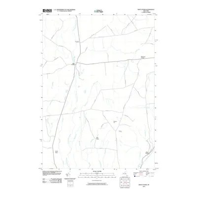
2010 Map of West Leyden
USGS Topo · Published 2010About this map
West Leyden serves as the primary hub of this central New York landscape, situated where the East Branch Mohawk River begins its course southward. The area is defined by a dense network of small watercourses, including Ava Brook, Wood Creek, and Blue Brook, which partition the rural terrain between small clusters of settlement. To the north, West Leyden Cemetery and the crossroads at Redmond Corner mark established points of community history, while further south, the landscape rises toward Webster Hill. Transportation is facilitated by a grid of rural roads such as Ziegler RD and E Ava RD, and the presence of the Valenty Mierek Airport adds a modern aviation element to this traditional agricultural and wooded setting. Genealogists may find interest in the documented sites of Thorton Cemetery and the small hamlet of Flint Town.
Find a feature on this map
57 named features on this map. Tap any name to fly to it.
Don’t see what you’re looking for? This feature index may not catch every label — zoom into the map to look around manually.
Map Details
Editions of this 2010 West Leyden Map
This is the sole edition of this map. No revisions or reprints were ever made.
Other maps of this area

1904 · Boonville
USGS Topo · 1:62,500

1905 · Port Leyden
USGS Topo · 1:62,500

1905 · Taberg
USGS Topo · 1:62,500

1906 · Highmarket
USGS Topo · 1:62,500

1907 · Port Leyden
USGS Topo · 1:62,500

1940 · Port Leyden
USGS Topo · 1:62,500

1943 · Lee Center
USGS Topo · 1:31,680

1943 · High Market
USGS Topo · 1:24,000

1944 · Point Rock
USGS Topo · 1:31,680
1944 · Highmarket
USGS Topo · 1:31,680