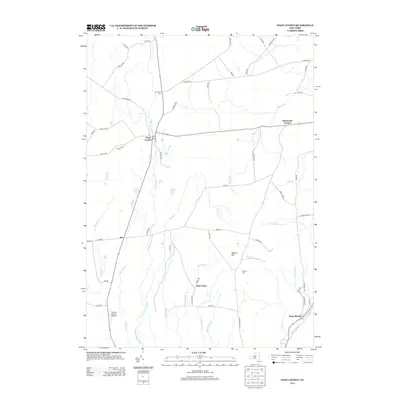
2013 Map of West Leyden
USGS Topo · Published 2013About this map
The E Br Mohawk River defines the western landscape of this Oneida County region, flowing through the settlement of West Leyden. This 2013 survey illustrates a rural upland characterized by small hamlets and agricultural crossroads, including Ava, Flint Town, and Redmond Corner. These communities are connected by a network of family-named roads like Deminuk Rd and Borwick Rd, reflecting a lineage of land ownership that persists into the 21st century. In the southeast, the historical path of the Black River Canal runs parallel to Lansing Kill, a remnant of the state's early waterway transportation system. Local history is anchored by several sites of interment, such as the W Leyden Cem and Thorton Cem, while the Valenty Mierek Airport serves as a modern landmark north of Tuffy Rd.
Find a feature on this map
68 named features on this map. Tap any name to fly to it.
Don’t see what you’re looking for? This feature index may not catch every label — zoom into the map to look around manually.
Map Details
Editions of this 2013 West Leyden Map
This is the sole edition of this map. No revisions or reprints were ever made.
Other maps of this area

1904 · Boonville
USGS Topo · 1:62,500

1905 · Port Leyden
USGS Topo · 1:62,500

1905 · Taberg
USGS Topo · 1:62,500

1906 · Highmarket
USGS Topo · 1:62,500

1907 · Port Leyden
USGS Topo · 1:62,500

1940 · Port Leyden
USGS Topo · 1:62,500

1943 · Lee Center
USGS Topo · 1:31,680

1943 · High Market
USGS Topo · 1:24,000

1944 · Point Rock
USGS Topo · 1:31,680
1944 · Highmarket
USGS Topo · 1:31,680