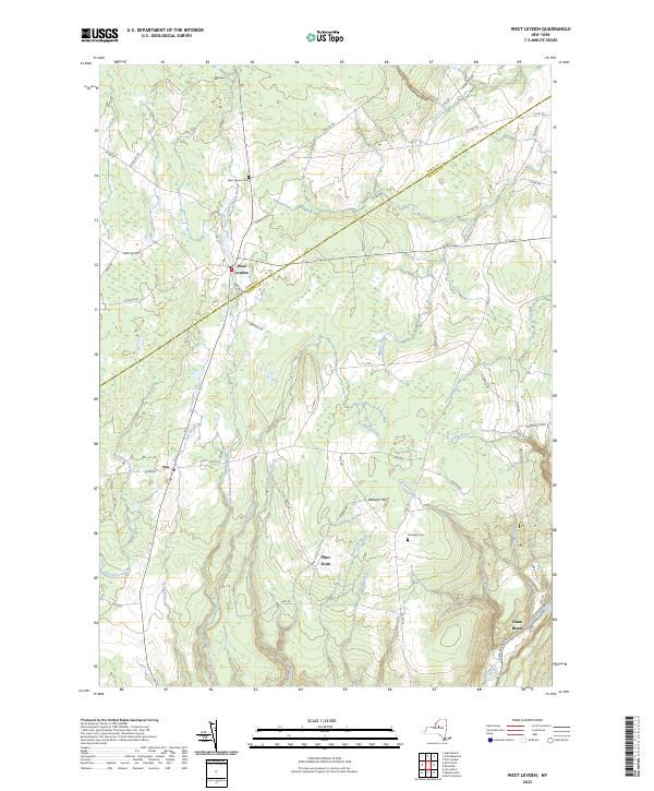
2023 Map of West Leyden
USGS Topo · Published 2023About this map
The upper reaches of the East Branch Mohawk River define this rural landscape near the border of Lewis and Oneida counties. Central to the area is West Leyden, a crossroads settlement north of Ava and Flint Town. The terrain is marked by numerous small tributaries like Chase Creek and Turtle Lot Brook that feed into the Mohawk system, reflecting the well-watered topography of the Tug Hill region. In the southeastern corner, the course of the Black River Canal follows the Lansing Kill valley, providing a clear record of 19th-century transportation infrastructure that once connected the Mohawk Valley to the North Country. Local genealogy is supported by the presence of the West Leyden Cem and Thornton Cem, while family-named roads like Apple Rd and Traxel Rd suggest long-standing land ownership patterns.
Find a feature on this map
62 named features on this map. Tap any name to fly to it.
Don’t see what you’re looking for? This feature index may not catch every label — zoom into the map to look around manually.
Map Details
Editions of this 2023 West Leyden Map
This is the sole edition of this map. No revisions or reprints were ever made.
Other maps of this area

1904 · Boonville
USGS Topo · 1:62,500

1905 · Port Leyden
USGS Topo · 1:62,500

1905 · Taberg
USGS Topo · 1:62,500

1906 · Highmarket
USGS Topo · 1:62,500

1907 · Port Leyden
USGS Topo · 1:62,500

1940 · Port Leyden
USGS Topo · 1:62,500

1943 · Lee Center
USGS Topo · 1:31,680

1943 · High Market
USGS Topo · 1:24,000

1944 · Point Rock
USGS Topo · 1:31,680
1944 · Highmarket
USGS Topo · 1:31,680