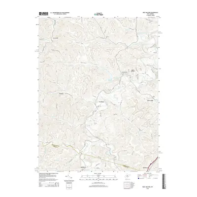
2014 Map of West Milford
USGS Topo · Published 2014About this map
West Milford serves as a central hub in this Harrison County landscape, situated where the West Fork River winds through a series of steep ridges and narrow valleys. The settlement pattern here is deeply tied to the river and its tributaries, including Hackers Creek and Isaacs Cr, with smaller communities like Goodhope, Jarvisville, and Sheets Mills marking historical crossroads. The rural character of the area is underscored by the high density of family and community burial grounds, such as Mt. Olive Cem, Sycamore Cem, and the Independent Order of Oddfellows Cem.
Find a feature on this map
109 named features on this map. Tap any name to fly to it.
Don’t see what you’re looking for? This feature index may not catch every label — zoom into the map to look around manually.
Map Details
Editions of this 2014 West Milford Map
This is the sole edition of this map. No revisions or reprints were ever made.
Other maps of this area

1902 · Clarksburg
USGS Topo · 1:62,500

1904 · Weston
USGS Topo · 1:62,500

1904 · Vadis
USGS Topo · 1:62,500

1905 · Centerpoint
USGS Topo · 1:62,500

1910 · Clarksburg
USGS Topo · 1:62,500

1923 · Clarksburg
USGS Topo · 1:62,500

1924 · Centerpoint
USGS Topo · 1:62,500

1925 · Clarksburg
USGS Topo · 1:62,500

1925 · Centerpoint
USGS Topo · 1:62,500

1925 · Vadis
USGS Topo · 1:62,500