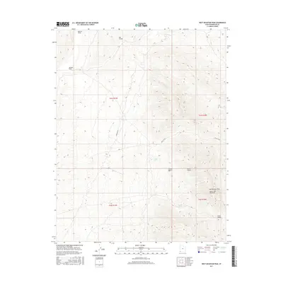
2017 Map of West Mountain Peak
USGS Topo · Published 2017About this map
West Mountain Peak anchors the high terrain of the Beaver Dam Mountains in this remote corner of Washington County, where the high desert transitions into the Mojave Desert. The landscape is defined by its arid geography and seasonal water sources, marked by several named springs including Badger Spring, Indian Spring, and Grapevine Spring. This 2017 survey illustrates a rugged expanse where natural landmarks like Red Hollow and Horse Canyon provide the primary orientation. Aside from the prominent Powerline Row cutting through the center of the sheet, the map reveals a wilderness largely devoid of modern infrastructure, preserving the drainage patterns of Jackson Wash and the surrounding peaks. Researchers will find a detailed representation of these geological features and the scattered water points that have long been critical for survival in this southwest Utah environment.
Find a feature on this map
18 named features on this map. Tap any name to fly to it.
Don’t see what you’re looking for? This feature index may not catch every label — zoom into the map to look around manually.
Map Details
Editions of this 2017 West Mountain Peak Map
This is the sole edition of this map. No revisions or reprints were ever made.
Other maps of this area

1885 · St. George
USGS Topo · 1:250,000

1885 · Pioche
USGS Topo · 1:250,000

1886 · Pioche
USGS Topo · 1:250,000

1891 · St. George
USGS Topo · 1:250,000

1953 · Cedar City
USGS Topo · 1:250,000

1954 · Caliente
USGS Topo · 1:250,000

1954 · Beaver Dam Mts NE
USGS Topo · 1:24,000

1954 · Gunlock
USGS Topo · 1:24,000

1954 · Beaver Dam Mts SE
USGS Topo · 1:24,000

1958 · Cedar City
USGS Topo · 1:250,000