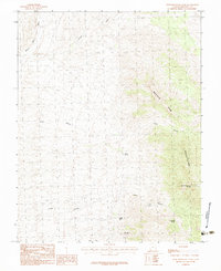
1983 Map of West Mountain Peak
USGS Topo · Published 1983About this map
West Mountain Peak dominates the skyline of the Beaver Dam Mountains in this high-altitude corner of Washington County. Surveyed by the U.S. Geological Survey and released in the early 1980s, the landscape is defined by its critical water sources and drainage patterns. A network of vital springs, including Grapevine Spring, Indian Spring, and Sam Spring, are dotted throughout the arid terrain, providing essential life to an area carved by massive erosional features like Horse Canyon and Indian Canyon. To the west, the topography opens into the broad drainage of Beaver Dam Wash, where several other seasonal washes like Jackson Wash and Reber Wash converge. The map illustrates a landscape of high-elevation peaks and deep-cut canyons, where name-bearing landmarks are often tied to the scattered desert springs that sustain them.
Find a feature on this map
12 named features on this map. Tap any name to fly to it.
Don’t see what you’re looking for? This feature index may not catch every label — zoom into the map to look around manually.
Map Details
Editions of this 1983 West Mountain Peak Map
This is the sole edition of this map. No revisions or reprints were ever made.
Other maps of this area

1885 · St. George
USGS Topo · 1:250,000

1885 · Pioche
USGS Topo · 1:250,000

1886 · Pioche
USGS Topo · 1:250,000

1891 · St. George
USGS Topo · 1:250,000

1953 · Cedar City
USGS Topo · 1:250,000

1954 · Caliente
USGS Topo · 1:250,000

1954 · Beaver Dam Mts NE
USGS Topo · 1:24,000

1954 · Gunlock
USGS Topo · 1:24,000

1954 · Beaver Dam Mts SE
USGS Topo · 1:24,000

1958 · Cedar City
USGS Topo · 1:250,000