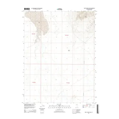
2014 Map of West of Beck Pass
USGS Topo · Published 2014About this map
Ruby Mountains dominate the northeastern corner of this Nevada landscape, where steep slopes descend into the expansive flats of the Newark Valley. The terrain highlights a classic Basin and Range transition, with high-elevation drainage patterns feeding the seasonal Newark Lake to the west. This 2014 survey documents the remote hydrology of the region, including the vital Barzel Spring located at the foot of the range. The only significant corridor for travel through this high desert environment is the Ruby Valley Rd, which skirts the eastern edge of the valley. The map clearly delineates the public land survey system grid, including townships t20n r56e and t19n r56e, providing a precise look at property and land divisions in White Pine County.
Find a feature on this map
9 named features on this map. Tap any name to fly to it.
Don’t see what you’re looking for? This feature index may not catch every label — zoom into the map to look around manually.
Map Details
Editions of this 2014 West of Beck Pass Map
This is the sole edition of this map. No revisions or reprints were ever made.
Other maps of this area

1951 · Pancake Summit
USGS Topo · 1:62,500

1953 · Pinto Summit
USGS Topo · 1:62,500

1953 · Eureka
USGS Topo · 1:62,500

1956 · Ely
USGS Topo · 1:250,000

1957 · Buck Mountain
USGS Topo · 1:62,500

1959 · Ely
USGS Topo · 1:250,000

1963 · Ely
USGS Topo · 1:250,000

1979 · Mt. Hamilton
USGS Topo · 1:100,000

1985 · Newark Lake
USGS Topo · 1:100,000
1990 · Buck Mountain East
USGS Topo · 1:24,000