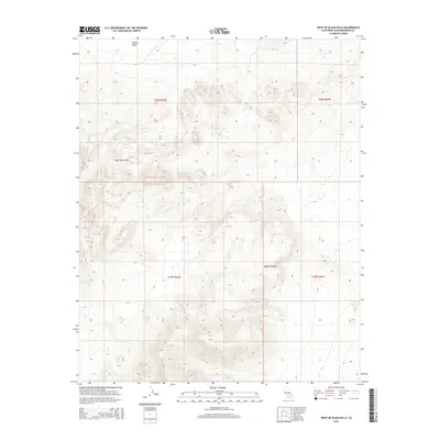
2015 Map of West of Black Hills
USGS Topo · Published 2015About this map
Lava Mountains dominate this arid landscape within the northern reaches of the Mojave Desert. This 2015 U.S. Geological Survey representation highlights the dramatic verticality of the terrain, where jagged contours define the transition from the southern extent of Searles Valley into the upland volcanic ranges. The map is primarily characterized by its topographical detail rather than human settlement, serving as a record of the public land survey system divisions across San Bernardino County. Precise township and range boundaries, including t28s r42e and t29s r43e, provide an essential framework for understanding property and mineral rights in a region defined by its geological formations and expansive open space.
Find a feature on this map
7 named features on this map. Tap any name to fly to it.
Don’t see what you’re looking for? This feature index may not catch every label — zoom into the map to look around manually.
Map Details
Editions of this 2015 West of Black Hills Map
This is the sole edition of this map. No revisions or reprints were ever made.
Other maps of this area

1903 · Randsburg
USGS Topo · 1:62,500

1911 · Randsburg
USGS Topo · 1:62,500

1912 · Randsburg
USGS Topo · 1:62,500

1915 · Searles Lake
USGS Topo · 1:250,000

1947 · Trona
USGS Topo · 1:250,000

1948 · Trona
USGS Topo · 1:250,000

1949 · Searles Lake
USGS Topo · 1:62,500

1950 · Searles Lake
USGS Topo · 1:62,500

1953 · Ridgecrest
USGS Topo · 1:62,500

1953 · Trona
USGS Topo · 1:250,000