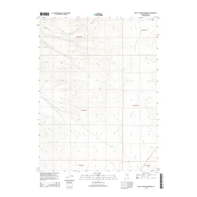
2014 Map of West of Coffin Mountain
USGS Topo · Published 2014About this map
Iron Mine Rd cuts across the northern reaches of this Eureka County landscape, signaling the area's industrial ties to the mineral extraction history of the Great Basin. The topography is defined by a series of drainage networks that flow toward Pine Valley to the east, including Big Pole Cr and Little Pole Cr. These intermittent and perennial streams create a distinct hydrologic pattern across the public land survey townships, which are meticulously gridded into sections. The presence of Box Springs highlights the critical importance of isolated water sources in this high-desert environment. To the southeast, smaller drainages such as Hot Cr, Pony Cr, and Dry Cr carve into the terrain, illustrating the complex watershed that eventually feeds into Pine Cr.
Find a feature on this map
17 named features on this map. Tap any name to fly to it.
Don’t see what you’re looking for? This feature index may not catch every label — zoom into the map to look around manually.
Map Details
Editions of this 2014 West of Coffin Mountain Map
This is the sole edition of this map. No revisions or reprints were ever made.
Other maps of this area

1937 · Mineral Hill
USGS Topo · 1:48,000

1943 · Mineral Hill
USGS Topo · 1:62,500

1952 · Pine Valley
USGS Topo · 1:62,500

1955 · Winnemucca
USGS Topo · 1:250,000

1957 · Frenchie Creek
USGS Topo · 1:62,500

1957 · Horse Creek Valley
USGS Topo · 1:62,500

1958 · Winnemucca
USGS Topo · 1:250,000

1962 · Winnemucca
USGS Topo · 1:250,000
1985 · Thatcher Spring
USGS Topo · 1:24,000
1985 · Coffin Mtn
USGS Topo · 1:24,000