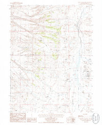
1985 Map of West of Coffin Mtn
USGS Topo · Published 1986About this map
Pine Valley serves as the central geographic feature of this mid-1980s Eureka County survey, where the drainages of Little Pole Creek and Pony Creek descend toward the valley floor. The landscape reflects a legacy of both ranching and extraction, evidenced by the presence of a Corral and numerous mining sites such as a Strip Mine and various Prospects. The eastern portion of the map is defined by the Old Railroad Grade, which runs parallel to Pine Creek, marking the historical transportation corridor that once served the remote mining districts of central Nevada. Water remains a critical element for the area's survival, with scattered resources like Box Springs, a Well, and a Stock Tank positioned to support livestock. This 1985 data documents the intersection of natural watercourses like Hot Creek and Sheep Creek with the industrial scars of open-pit mining operations and prospecting pits.
Find a feature on this map
20 named features on this map. Tap any name to fly to it.
Don’t see what you’re looking for? This feature index may not catch every label — zoom into the map to look around manually.
Map Details
Editions of this 1985 West of Coffin Mtn Map
This is the sole edition of this map. No revisions or reprints were ever made.
Other maps of this area

1937 · Mineral Hill
USGS Topo · 1:48,000

1943 · Mineral Hill
USGS Topo · 1:62,500

1952 · Pine Valley
USGS Topo · 1:62,500

1955 · Winnemucca
USGS Topo · 1:250,000

1957 · Frenchie Creek
USGS Topo · 1:62,500

1957 · Horse Creek Valley
USGS Topo · 1:62,500

1958 · Winnemucca
USGS Topo · 1:250,000

1962 · Winnemucca
USGS Topo · 1:250,000
1985 · Thatcher Spring
USGS Topo · 1:24,000
1985 · Coffin Mtn
USGS Topo · 1:24,000