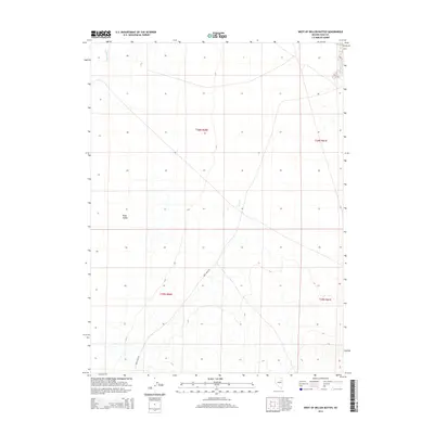
2014 Map of West of Delcer Buttes
USGS Topo · Published 2014About this map
Ruby Valley characterizes the western reaches of the Delcer Buttes area, where the high desert terrain transitions toward the base of the mountains. This 2014 survey documents the sparse but vital transport network of Elko County, centered on the winding path of Ruby Wash Rd. The landscape is defined by its drainage patterns, most notably the seasonal course of the Franklin River which enters from the north. The map provides a detailed look at the Public Land Survey System grid, including townships t30n r60e, t30n r61e, t29n r60e, and t29n r61e. These boundaries and section lines are essential for researchers tracing land ownership or historical ranching parcels in this expansive Nevada basin.
Find a feature on this map
7 named features on this map. Tap any name to fly to it.
Don’t see what you’re looking for? This feature index may not catch every label — zoom into the map to look around manually.
Map Details
Editions of this 2014 West of Delcer Buttes Map
This is the sole edition of this map. No revisions or reprints were ever made.
Other maps of this area

1935 · Halleck
USGS Topo · 1:125,000

1955 · Elko
USGS Topo · 1:250,000

1958 · Elko
USGS Topo · 1:250,000

1962 · Elko
USGS Topo · 1:250,000

1962 · Lamoille
USGS Topo · 1:62,500

1965 · Elko
USGS Topo · 1:250,000

1968 · Franklin Lake SE
USGS Topo · 1:24,000

1968 · Franklin Lake NE
USGS Topo · 1:24,000

1984 · West of Delcer Buttes
USGS Topo · 1:24,000

1984 · Valley Mtn
USGS Topo · 1:24,000