
1968 Map of Franklin Lake SE
USGS Topo · Published 1971About this map
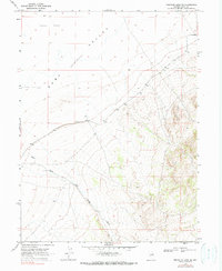
The arid drainage patterns of Ruby Valley (Depression) dominate this landscape in eastern Nevada as it appeared in the late 1960s. The topography is defined by the expansive Alkali Flat, where seasonal moisture and evaporation leave behind characteristic mineral deposits. Slicing through the southern portion of the sheet, the Ruby Wash provides a primary drainage corridor toward the valley floor, an essential geographical feature for understanding the hydrology of this high-desert basin. Human activity is indicated by sparse infrastructure, primarily a Jeep Trail that navigates the lower elevations and a lonely Well noted in the center of the valley. The map documents the vast, open character of the region before significant modern changes, preserving the locations of range fence lines and section boundaries such as those for Townships 28 and 29 North.
Find a feature on this map
8 named features on this map. Tap any name to fly to it.
Don’t see what you’re looking for? This feature index may not catch every label — zoom into the map to look around manually.
Map Details
Editions of this 1968 Franklin Lake SE Map
2 editions found
Other maps of this area

1955 · Elko
USGS Topo · 1:250,000

1958 · Elko
USGS Topo · 1:250,000

1962 · Elko
USGS Topo · 1:250,000

1965 · Elko
USGS Topo · 1:250,000

1968 · Franklin Lake SW
USGS Topo · 1:24,000

1968 · Franklin Lake NE
USGS Topo · 1:24,000
1968 · Ruby Lake NW
USGS Topo · 1:24,000

1968 · Ruby Lake NE
USGS Topo · 1:24,000
1969 · Franklin Lake NW
USGS Topo · 1:24,000

1984 · West of Delcer Buttes
USGS Topo · 1:24,000