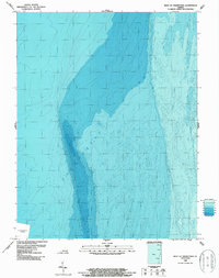
1986 Map of West of Franktown
USGS Topo · Published 1987About this map
Chesapeake Bay bathymetry dominates this 1980s nautical study, detailing the underwater contours and marine topography off the Virginia coast. The map illustrates a complex network of submerged channels and shoals, providing a technical look at the seafloor character in an area essential for regional maritime navigation. A specific Disposal Area is demarcated in the southwestern portion of the sheet, reflecting mid-century maritime management and sediment deposition practices. Compiled from National Ocean Service hydrographic surveys, the data captures the precise depths and varying gradients of the coastal shelf at a time when precision mapping was becoming increasingly sophisticated through tide-coordinated data collection.
Find a feature on this map
2 named features on this map. Tap any name to fly to it.
Don’t see what you’re looking for? This feature index may not catch every label — zoom into the map to look around manually.
Map Details
Editions of this 1986 West of Franktown Map
This is the sole edition of this map. No revisions or reprints were ever made.
Other maps of this area

1942 · Cheriton
USGS Topo · 1:24,000

1943 · Jamesville
USGS Topo · 1:31,680

1943 · Franktown
USGS Topo · 1:31,680

1943 · Richmond
USGS Topo · 1:250,000

1946 · Eastville
USGS Topo · 1:250,000

1948 · Cape Charles
USGS Topo · 1:24,000

1949 · Richmond
USGS Topo · 1:250,000
1955 · Cape Charles
USGS Topo · 1:24,000
1955 · Cheriton
USGS Topo · 1:24,000

1959 · Richmond
USGS Topo · 1:250,000