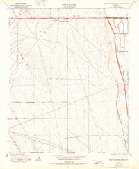
1950 Map of West of Goose Lake
USGS Topo · Published 1950About this map
Lost Hills sits at the northern edge of this Kern County survey, positioned along the vital transit corridor of the Bakersfield Paso Robles Road. The landscape is dominated by the prominent elevation of the Lost Hills, which rise above the surrounding valley floor and separate the settlement from the low-lying basin to the east. The Lost Hills Sch serves as a central community landmark for the local population during this era of mid-century development. To the east, the agricultural and hydraulic character of the San Joaquin Valley is evident where the West Side Canal skirts the edge of the Goose Lake basin. The map illustrates a transition from the elevated, surveyed sections of the hills to the managed water systems that supported the region's expanding land use in the early 1950s.
Find a feature on this map
6 named features on this map. Tap any name to fly to it.
Don’t see what you’re looking for? This feature index may not catch every label — zoom into the map to look around manually.
Map Details
Editions of this 1950 West of Goose Lake Map
This is the sole edition of this map. No revisions or reprints were ever made.
Other maps of this area

1912 · McKittrick
USGS Topo · 1:125,000

1914 · Lost Hills
USGS Topo · 1:125,000

1927 · Semitropic
USGS Topo · 1:31,680

1930 · Miramonte Ranch
USGS Topo · 1:31,680

1931 · Lokern
USGS Topo · 1:31,680

1931 · Goose Lake
USGS Topo · 1:31,680

1932 · Antelope Plain
USGS Topo · 1:31,680

1932 · West of Goose Lake
USGS Topo · 1:31,680

1932 · Reynolds Ranch
USGS Topo · 1:31,680

1934 · Lokern
USGS Topo · 1:31,680