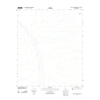
2011 Map of West of Growler Peak
USGS Topo · Published 2011About this map
Growler Wash meanders across the arid terrain of this Pima County landscape, serving as the dominant hydrological feature in a region defined by its desert character. The 2011 survey by the U.S. Geological Survey illustrates the braided drainage patterns typical of the Sonoran Desert, where seasonal waters move from the higher elevations toward the alluvial plains. To the northeast, the foothills of the Growler Mountains rise as a prominent topographic boundary, influencing the direction of the various dry washes that spider across the sheet. This map captures the stark, unpopulated nature of the borderlands, where the primary geographical markers are the shifting sands and natural landforms rather than human settlements or road networks.
Find a feature on this map
2 named features on this map. Tap any name to fly to it.
Don’t see what you’re looking for? This feature index may not catch every label — zoom into the map to look around manually.
Map Details
Editions of this 2011 West of Growler Peak Map
This is the sole edition of this map. No revisions or reprints were ever made.
Other maps of this area

1927 · Aguila Mountains
USGS Topo · 1:48,000

1930 · Aguila Mountains
USGS Topo · 1:62,500

1953 · Ajo
USGS Topo · 1:250,000

1957 · Ajo
USGS Topo · 1:250,000

1958 · Ajo
USGS Topo · 1:250,000

1962 · Ajo
USGS Topo · 1:250,000

1963 · Ajo
USGS Topo · 1:250,000

1964 · Growler Peak
USGS Topo · 1:62,500
1965 · Aguila Mountains
USGS Topo · 1:62,500

1965 · Granite Mountains
USGS Topo · 1:62,500