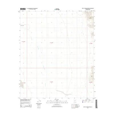
2014 Map of West of Growler Peak
USGS Topo · Published 2014About this map
Growler Valley dominates the central and western expanse of this 2014 survey in Pima County, Arizona, illustrating a classic Sonoran Desert drainage system. The terrain is defined by the ephemeral Growler Wash, which bisects the valley as it flows toward the northwest. Along the eastern edge of the quadrangle, the elevation rises sharply into the Growler Mountains, a desert range characterized by steep slopes and prominent summits. Sheep Peak stands as a notable landmark in the southeastern portion of the mountains, overlooking the alluvial fans and complex network of smaller desert washes that feed into the valley floor. The map highlights the contrast between the flat, open valley floor and the high-relief mountain topography, providing a clear view of the natural water distribution and landform orientation in this arid landscape.
Find a feature on this map
4 named features on this map. Tap any name to fly to it.
Don’t see what you’re looking for? This feature index may not catch every label — zoom into the map to look around manually.
Map Details
Editions of this 2014 West of Growler Peak Map
This is the sole edition of this map. No revisions or reprints were ever made.
Other maps of this area

1927 · Aguila Mountains
USGS Topo · 1:48,000

1930 · Aguila Mountains
USGS Topo · 1:62,500

1953 · Ajo
USGS Topo · 1:250,000

1957 · Ajo
USGS Topo · 1:250,000

1958 · Ajo
USGS Topo · 1:250,000

1962 · Ajo
USGS Topo · 1:250,000

1963 · Ajo
USGS Topo · 1:250,000

1964 · Growler Peak
USGS Topo · 1:62,500
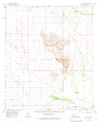
1965 · Aguila Mountains
USGS Topo · 1:62,500

1965 · Granite Mountains
USGS Topo · 1:62,500