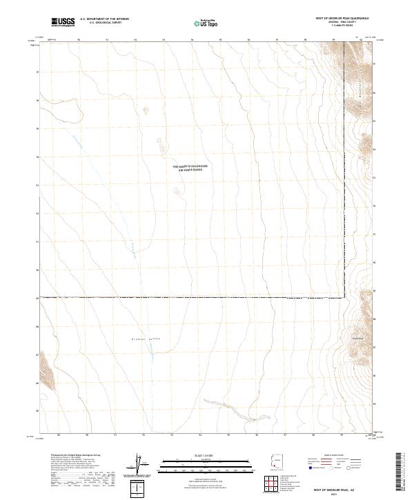
2021 Map of West of Growler Peak
USGS Topo · Published 2021About this map
Growler Valley dominates this arid landscape in Pima County, defined by its stark separation of drainage basins and rising mountain massifs. The area is anchored by the Growler Mountains in the northeast and the prominent summit of Sheep Peak to the southeast, which serves as a significant topographical landmark for the region. The valley floor is carved by the intermittent path of Growler Wash, which threads through the center of the sheet.
Find a feature on this map
10 named features on this map. Tap any name to fly to it.
Don’t see what you’re looking for? This feature index may not catch every label — zoom into the map to look around manually.
Map Details
Editions of this 2021 West of Growler Peak Map
This is the sole edition of this map. No revisions or reprints were ever made.
Other maps of this area

1927 · Aguila Mountains
USGS Topo · 1:48,000

1930 · Aguila Mountains
USGS Topo · 1:62,500

1953 · Ajo
USGS Topo · 1:250,000

1957 · Ajo
USGS Topo · 1:250,000

1958 · Ajo
USGS Topo · 1:250,000

1962 · Ajo
USGS Topo · 1:250,000

1963 · Ajo
USGS Topo · 1:250,000

1964 · Growler Peak
USGS Topo · 1:62,500
1965 · Aguila Mountains
USGS Topo · 1:62,500

1965 · Granite Mountains
USGS Topo · 1:62,500