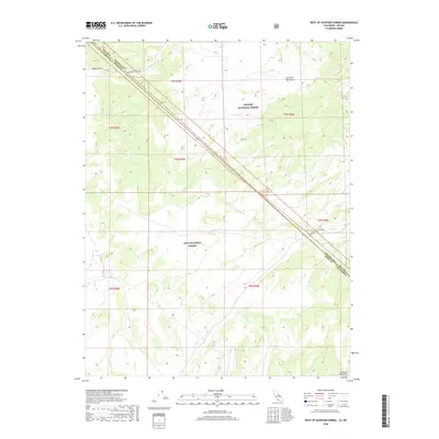
2018 Map of West of Huntoon Spring
USGS Topo · Published 2018About this map
The high desert borderlands between Mono County, California, and Mineral County, Nevada, are defined here by a sharp diagonal transition across the Great Basin. The Toiyabe National Forest and Inyo National Forest meet in this arid corridor, where the Excelsior Mountains rise to the north and the Huntoon Mountains anchor the southeast. Transportation through this remote stretch is dictated by the landscape, primarily following the Huntoon Valley Trail and the Excelsior Access. The drainage of Huntoon Cr cuts through the center of the quadrangle, providing a vital water reference in an otherwise high-elevation desert environment marked by features like Deep Cañon. This survey documents the precise boundary lines where state and national forest jurisdictions intersect amidst the prominent ridgelines of the eastern Sierra region.
Find a feature on this map
14 named features on this map. Tap any name to fly to it.
Don’t see what you’re looking for? This feature index may not catch every label — zoom into the map to look around manually.
Map Details
Editions of this 2018 West of Huntoon Spring Map
This is the sole edition of this map. No revisions or reprints were ever made.
Other maps of this area

1909 · Hawthorne
USGS Topo · 1:250,000

1911 · Hawthorne
USGS Topo · 1:250,000

1914 · Mt. Morrison
USGS Topo · 1:125,000

1915 · Hawthorne
USGS Topo · 1:250,000

1947 · Mariposa
USGS Topo · 1:250,000

1948 · Walker Lake
USGS Topo · 1:250,000

1948 · Mariposa
USGS Topo · 1:250,000

1957 · Walker Lake
USGS Topo · 1:250,000

1957 · Mariposa
USGS Topo · 1:250,000

1958 · Trench Canyon
USGS Topo · 1:62,500