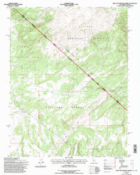
1994 Map of West of Huntoon Spring
USGS Topo · Published 1997About this map
The Von Schmidt Boundary slices diagonally across this high-elevation terrain, marking the 19th-century survey line between California and Nevada. This high-desert landscape is defined by the convergence of the Toiyabe National Forest and the Inyo National Forest, where the Excelsior Mountains meet the Adobe Hills. The map details a network of primitive 4WD tracks and trails that navigate the arid topography, serving as the primary infrastructure for this remote region. Water features are sparse but critical, evidenced by the presence of Huntoon Creek and a localized Cistern, highlighting the resource management necessary in these national forest lands during the late twentieth century.
Find a feature on this map
12 named features on this map. Tap any name to fly to it.
Don’t see what you’re looking for? This feature index may not catch every label — zoom into the map to look around manually.
Map Details
Editions of this 1994 West of Huntoon Spring Map
This is the sole edition of this map. No revisions or reprints were ever made.
Other maps of this area

1909 · Hawthorne
USGS Topo · 1:250,000

1911 · Hawthorne
USGS Topo · 1:250,000

1914 · Mt. Morrison
USGS Topo · 1:125,000

1915 · Hawthorne
USGS Topo · 1:250,000

1947 · Mariposa
USGS Topo · 1:250,000

1948 · Walker Lake
USGS Topo · 1:250,000

1948 · Mariposa
USGS Topo · 1:250,000

1957 · Walker Lake
USGS Topo · 1:250,000

1957 · Mariposa
USGS Topo · 1:250,000

1958 · Trench Canyon
USGS Topo · 1:62,500