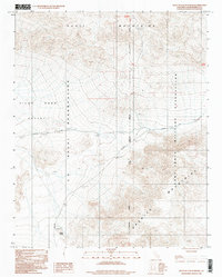
1996 Map of West of Leach Spring
USGS Topo · Published 1998About this map
Fort Irwin Military Reservation and the U S Naval Reservation dominate this high-desert landscape in northern San Bernardino County. The geography is defined by significant topographic shifts between the Quail Mountains to the north and the Granite Mountains to the south. This area serves as a critical junction for federal land management and military activity, with the San Bernardino Meridian acting as the primary north-south survey baseline through the center of the sheet.
Find a feature on this map
13 named features on this map. Tap any name to fly to it.
Don’t see what you’re looking for? This feature index may not catch every label — zoom into the map to look around manually.
Map Details
Editions of this 1996 West of Leach Spring Map
This is the sole edition of this map. No revisions or reprints were ever made.
Other maps of this area

1915 · Searles Lake
USGS Topo · 1:250,000

1933 · Avawatz Mountains
USGS Topo · 1:250,000

1947 · Trona
USGS Topo · 1:250,000

1948 · Trona
USGS Topo · 1:250,000

1948 · Quail Mountains
USGS Topo · 1:62,500

1948 · Goldstone Lake
USGS Topo · 1:62,500

1950 · Wingate Pass
USGS Topo · 1:62,500

1951 · Goldstone Lake
USGS Topo · 1:62,500

1951 · Wingate Pass
USGS Topo · 1:62,500

1951 · Quail Mountains
USGS Topo · 1:62,500