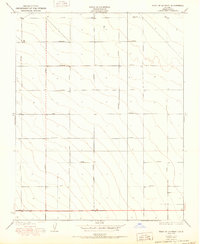
1950 Map of West of Lethent
USGS Topo · Published 1950About this map
Agricultural development and industrial planning define this mid-century landscape in Fresno County. Surveyed by J.L. Lewis, the region exhibits a rigid, car-centric nomenclature with parallel thoroughfares named after early automotive manufacturers, including Packard Avenue, Ford Avenue, and Chandler Avenue. This 1950 edition captures the systematic grid of the San Joaquin Valley just as the postwar period accelerated regional land use. The alignment of secondary routes like Lassen Avenue and Siskiyou Avenue provides a clear framework for local-history researchers tracing land parcels and original property boundaries in this productive interior valley. The topography remains relatively uniform, emphasizing the human engineering applied to the terrain through these surveyed lines.
Find a feature on this map
14 named features on this map. Tap any name to fly to it.
Don’t see what you’re looking for? This feature index may not catch every label — zoom into the map to look around manually.
Map Details
Editions of this 1950 West of Lethent Map
This is the sole edition of this map. No revisions or reprints were ever made.
Other maps of this area

1912 · Coalinga
USGS Topo · 1:125,000

1926 · Lethent
USGS Topo · 1:31,680

1927 · Burrel
USGS Topo · 1:31,680

1928 · Delta Farms No 3
USGS Topo · 1:31,680

1929 · Westhaven
USGS Topo · 1:31,680

1931 · Wheatville
USGS Topo · 1:31,680

1931 · Towne Oil Station
USGS Topo · 1:31,680

1932 · Delta Farms
USGS Topo · 1:31,680

1932 · West of Lethent
USGS Topo · 1:31,680

1933 · Huron
USGS Topo · 1:31,680