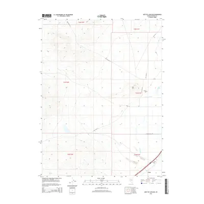
2015 Map of West of Lovelock
USGS Topo · Published 2015About this map
Perth serves as a focal point in this high-desert landscape, where the flatlands of the Humboldt River valley meet the rising terrain of the Trinity Range. The map reveals an intricate network of water management essential for ranching and agriculture, featuring the Taylor Canal, Lower Taylor Ditch, and Willow Slough. These man-made and natural watercourses define the lower elevations, supporting local holdings like those found along Big Meadow Ranch Rd. Historical burial sites, including Lone Mountain Cem and Big Meadow Cem, provide significant touchpoints for genealogical research in Pershing County. Rising above the valley floor, Lone Mtn stands as a prominent landmark near the junction of NV-399 and Lone Mountain Rd, marking the transition from irrigated ranch land to the more arid western interior accessed by Seven Troughs Rd.
Find a feature on this map
22 named features on this map. Tap any name to fly to it.
Don’t see what you’re looking for? This feature index may not catch every label — zoom into the map to look around manually.
Map Details
Editions of this 2015 West of Lovelock Map
This is the sole edition of this map. No revisions or reprints were ever made.
Other maps of this area

1931 · Lovelock
USGS Topo · 1:250,000

1935 · Lovelock
USGS Topo · 1:250,000

1955 · Lovelock
USGS Topo · 1:250,000

1956 · Oreana
USGS Topo · 1:62,500

1956 · Toulon
USGS Topo · 1:62,500

1956 · Lovelock
USGS Topo · 1:62,500

1959 · Lovelock
USGS Topo · 1:250,000

1981 · Trinity Pass
USGS Topo · 1:24,000

1981 · Poker Brown Spring
USGS Topo · 1:24,000

1984 · Lovelock
USGS Topo · 1:100,000