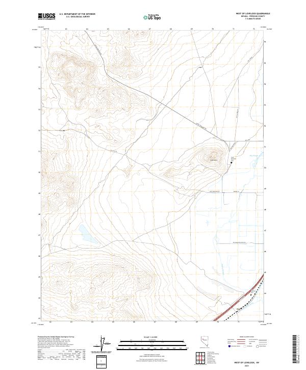
2021 Map of West of Lovelock
USGS Topo · Published 2021About this map
Lone Mtn rises as a prominent landmark in this Great Basin landscape, situated just northwest of the Humboldt River valley. The terrain transitions from the sloping base of the mountain into a complex network of agricultural irrigation and drainage features. The lower elevations are defined by the Willow Slough and Big Slough, alongside man-made improvements like the Lovelock Drain and Toulon Drain. These waterways suggest a history of water management essential for ranching and farming in the arid Pershing County climate.
Find a feature on this map
24 named features on this map. Tap any name to fly to it.
Don’t see what you’re looking for? This feature index may not catch every label — zoom into the map to look around manually.
Map Details
Editions of this 2021 West of Lovelock Map
This is the sole edition of this map. No revisions or reprints were ever made.
Other maps of this area

1931 · Lovelock
USGS Topo · 1:250,000

1935 · Lovelock
USGS Topo · 1:250,000

1955 · Lovelock
USGS Topo · 1:250,000

1956 · Oreana
USGS Topo · 1:62,500

1956 · Toulon
USGS Topo · 1:62,500

1956 · Lovelock
USGS Topo · 1:62,500

1959 · Lovelock
USGS Topo · 1:250,000

1981 · Trinity Pass
USGS Topo · 1:24,000

1981 · Poker Brown Spring
USGS Topo · 1:24,000

1984 · Lovelock
USGS Topo · 1:100,000