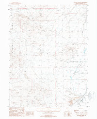
1987 Map of West of Lovelock
USGS Topo · Published 1988About this map
The Trinity Range dominates the western horizon of this high-desert landscape in Pershing County, Nevada. To the east, the terrain transitions into a complex network of agricultural and industrial water management, including the Old Channel Canal and several irrigation channels such as Upper Taylor Ditch and Lower Taylor Ditch. This 1980s-era survey highlights the intersection of the region's transport history and extractive industries, featuring the Old Toll Road winding through the foothills while numerous prospects and gravel pits dot the valley floor. Near the Southern Pacific line, the small settlement of Perth and the Big Meadow Pit provide evidence of the local infrastructure supporting Nevada's railway and mining economy. Genealogists may find interest in the documented locations of Lone Mtn Cem and another cemetery situated near Lone Mountain.
Find a feature on this map
21 named features on this map. Tap any name to fly to it.
Don’t see what you’re looking for? This feature index may not catch every label — zoom into the map to look around manually.
Map Details
Editions of this 1987 West of Lovelock Map
This is the sole edition of this map. No revisions or reprints were ever made.
Other maps of this area

1931 · Lovelock
USGS Topo · 1:250,000

1935 · Lovelock
USGS Topo · 1:250,000

1955 · Lovelock
USGS Topo · 1:250,000

1956 · Oreana
USGS Topo · 1:62,500

1956 · Toulon
USGS Topo · 1:62,500

1956 · Lovelock
USGS Topo · 1:62,500

1959 · Lovelock
USGS Topo · 1:250,000

1981 · Trinity Pass
USGS Topo · 1:24,000

1981 · Poker Brown Spring
USGS Topo · 1:24,000

1984 · Lovelock
USGS Topo · 1:100,000