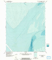
1986 Map of West of Nandua Creek
USGS Topo · Published 1993About this map
Chesapeake Bay dominates this bathymetric study, revealing the complex underwater topography off the coast of Accomack County during the mid-1980s. Unlike standard topographic sheets, this specialized survey focuses on the submerged landscape, charting depth gradients and the seafloor profile. A distinct Channel is visible in the southwestern portion of the quadrangle, indicating the natural scouring and navigational paths carved through the bay floor. The lack of terrestrial culture or drainage features on this specific sheet emphasizes the importance of maritime navigation and marine geology. These hydrographic details were compiled by the National Ocean Service to document the shifting shoals and underwater contours as they existed before 1990s revisions.
Find a feature on this map
2 named features on this map. Tap any name to fly to it.
Don’t see what you’re looking for? This feature index may not catch every label — zoom into the map to look around manually.
Map Details
Editions of this 1986 West of Nandua Creek Map
2 editions found
Other maps of this area

1903 · Crisfield
USGS Topo · 1:62,500

1917 · Ewell
USGS Topo · 1:62,500

1920 · Crisfield
USGS Topo · 1:62,500

1942 · Nandua Creek
USGS Topo · 1:24,000

1942 · Tangier Island
USGS Topo · 1:24,000

1943 · Jamesville
USGS Topo · 1:31,680
1943 · Tangier Island
USGS Topo · 1:31,680

1943 · Richmond
USGS Topo · 1:250,000

1946 · Eastville
USGS Topo · 1:250,000

1949 · Richmond
USGS Topo · 1:250,000